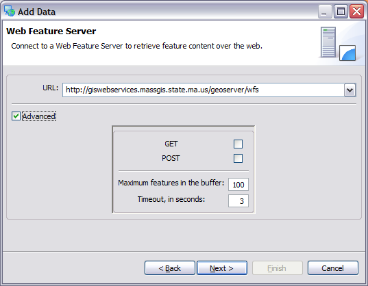
Web Feature Server page
The Web Feature Server page of the Add Data wizard is used to connect to to OGC Web Feature Servers. Web Feature Servers provide direct access to raw feature data (rather than simply a picture).
Field
Description
URL
The capabilities document of the web feature service.
Currently uDig supports WFS 1.0 servers, making use of the GML2 format.
Advanced Configuration Options
These settings are optional and are only of interest if you are performance tunning or having trouble connecting using the defaults.
Field
Description
GET
Service may be accessed using HTTP Get
POST
Service may be accessed using HTTP Post, helpful when making complicated queries by hand.
Maximum Features
The default value of 100 is fine, lower values may be needed when working with large individual features with lots of attributes. Higher values may be worth while when working with point data.
Timeout
You may wish to adjust this delay based of service reliability
Related tasks
Related concepts
Related reference